
The Earthquake Engineering Online Archive NISEE e-Library
 Identifier: Text-LIB050301
Title: Mapping of earthquake-induced liquefaction for seismic zonation
Creator(s): Youd, T. Leslie
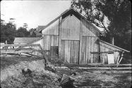
 Identifier: Image-LP0380
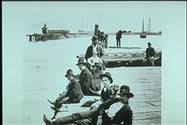
Title: Completing the seawall at the Embarcadero, 1881
Creator(s): unknown
 Identifier: Image-LP0396
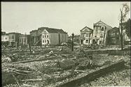
Title: 1906, 6th Street near Howard
Creator(s): unknown
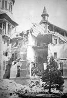
 Identifier: Image-LP0398
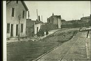
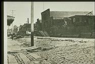
Title: Dore St. near Brannan, 1906
Creator(s): unknown
 Identifier: Image-LP0399
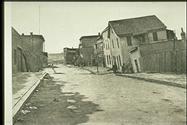
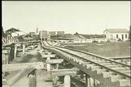
Title: Dore St., South of Market, 1906
Creator(s): unknown
 Identifier: Image-LP0402
Title: Mission District, 1906
Creator(s): unknown
 Identifier: Image-LP0404
Title: 18th Street, 1906
Creator(s): unknown
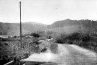
 Identifier: Image-LP0450
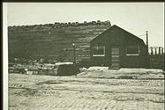
Title: Moss Landing after the 1906 earthquake
Creator(s): unknown
 Identifier: Image-LP0451
Title: Adjacent to the Salinas River
Creator(s): unknown
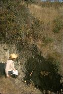
 Identifier: Image-LP0455
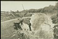
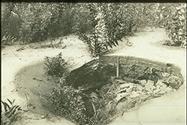
Title: Liquefaction in agricultural field, 1906
Creator(s): unknown
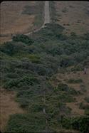
 Identifier: Image-R0334
Title: The San Andreas Fault in Daly City
Creator(s):
 Identifier: Image-R0335
Title: Santa Rosa 1906
Creator(s):
 Identifier: Image-R0337
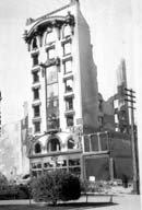
Title: 8-story masonry building, gutted
Creator(s):
 Identifier: Image-R0338
Title: Agnews State Hospital
Creator(s):
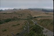
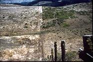
 Identifier: Image-R0340
Title: Marin County, 21 ft. horizontal offset
Creator(s):
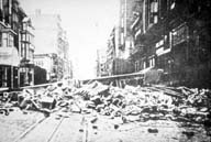 Identifier: Image-R0341
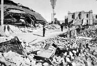
Title: Market Street
Creator(s):
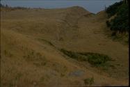
 Identifier: Image-S1253
Title: 1906 fault trace, Shelter Cove
Creator(s): Steinbrugge, Karl V.
 Identifier: Image-S1258
Title: 1906 fault scarp
Creator(s): Steinbrugge, Karl V.
 Identifier: Image-S1259
Title: 1906 fault scarp
Creator(s): Steinbrugge, Karl V.
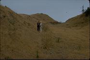
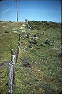
 Identifier: Image-S1260
Title: Fence offset by 1906 faulting
Creator(s): Steinbrugge, Karl V.
 Identifier: Image-S1261
Title: Fence offset by 1906 faulting
Creator(s): Steinbrugge, Karl V.
 Identifier: Image-S1265
Title: San Andreas Fault
Creator(s): Steinbrugge, Karl V.
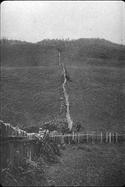
 Identifier: Image-S1277
Title: The 1906 faulting offset this fence
Creator(s): Bonilla, Manuel G.
 Identifier: Image-S1278
Title: The 1906 faulting offset this fence
Creator(s): Bonilla, Manuel G.
Identifier: Text-S21310
Title: Excerpts from San Francisco Municipal reports for the fiscal year 1905-6 : ending June 30, 1906 and fiscal year 1906-7, ending June 30, 1907
Creator(s):
Identifier: Text-S21660
Title: Damage in San Mateo County, California in the earthquake of 18 April 1906
Creator(s): Nason, Robert D.
Identifier: Text-S22326
Title: Earthquakes and building construction; a review of authoritative engineering data and records of experience
Creator(s):
Identifier: Text-S27207
Title: Damage in Santa Clara and Santa Cruz Counties, California, caused by the earthquake of 18 April 1906
Creator(s): Nason, Robert D.
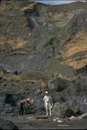
 Identifier: Image-S3013
Title: East-west fence
Creator(s): Matthes, François Émile
 Identifier: Image-S3014
Title: Fault-trace at the Skinner place
Creator(s): Gilbert, Grove K.