
The Earthquake Engineering Online Archive NISEE e-Library
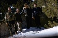 Identifier: Image-S669
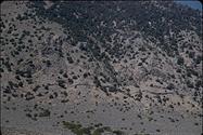
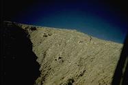
Title: Fairview Peak, looking southwest
Creator(s): Steinbrugge, Karl V.
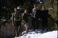 Identifier: Image-S670
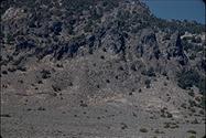
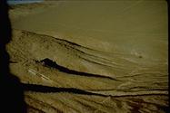
Title: Fairview Peak, Nevada
Creator(s): Steinbrugge, Karl V.
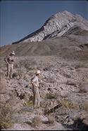 Identifier: Image-S671
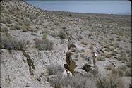
Title: Drainage channel leads to faulting
Creator(s): Steinbrugge, Karl V.
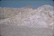 Identifier: Image-S672
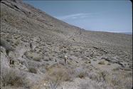
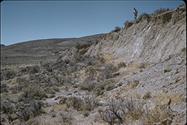
Title: Typical fault scarp in this area
Creator(s): Steinbrugge, Karl V.
 Identifier: Image-S673
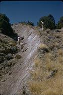
Title: Measuring scarp
Creator(s): Steinbrugge, Karl V.
 Identifier: Image-S674
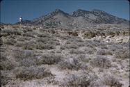
Title: Stillwater Range, Dixie Valley
Creator(s): Steinbrugge, Karl V.
 Identifier: Image-S675
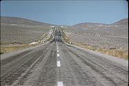
Title: Looking west along US Highway 50
Creator(s): Steinbrugge, Karl V.
 Identifier: Image-S676
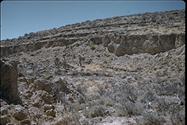
Title: Relatively little weathering to scarp
Creator(s): Steinbrugge, Karl V.
 Identifier: Image-S677
Title: Vertical displacement
Creator(s): Steinbrugge, Karl V.
 Identifier: Image-S678
Title: Some indications of right lateral movement
Creator(s): Steinbrugge, Karl V.
 Identifier: Image-S679
Title: Indications of right lateral movement
Creator(s): Steinbrugge, Karl V.
 Identifier: Image-S680
Title: Start of a parallel break
Creator(s): Steinbrugge, Karl V.
 Identifier: Image-S681
Title: Don Moran on top of scarp
Creator(s): Steinbrugge, Karl V.
 Identifier: Image-S682
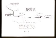
Title: Largest graben found in this earthquake
Creator(s): Steinbrugge, Karl V.
 Identifier: Image-S683
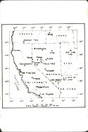
Title: Map of southwestern U.S. showing "felt" area
Creator(s): .
 Identifier: Image-S684
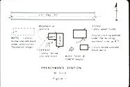
Title: Plot plan of Frenchman's Station
Creator(s): .
 Identifier: Image-S685
Title: Cross-section at wood frame structure found in graben
Creator(s): .
 Identifier: Image-S686
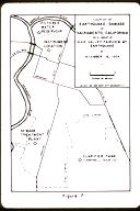
Title: Map of Sacramento and vicinity
Creator(s): .
 Identifier: Image-S687
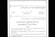
Title: Record from Weed Seismograph located in Sacramento
Creator(s): .
 Identifier: Image-S688
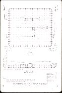
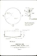
Title: Plan of water reservoir damaged by the earthquake
Creator(s): .
 Identifier: Image-S689
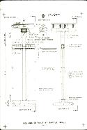
Title: Details of construction of Filtered Water Reservoir
Creator(s): .
 Identifier: Image-S690
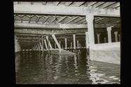
Title: Damaged gunite wall and broken precast concrete columns
Creator(s): unknown
 Identifier: Image-S691
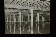
Title: Damaged gunite wall and broken precast concrete columns
Creator(s): unknown
 Identifier: Image-S692
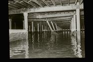
Title: Damaged gunite wall and broken precast concrete columns
Creator(s): unknown
 Identifier: Image-S693
Title: Sewage Treatment Plant
Creator(s): .
 Identifier: Image-S694
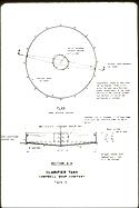
Title: Clarifier tank at Campbell Soup Plant
Creator(s): .
 Identifier: Image-S696
Title: Seismogram record for Weed
Creator(s): .
 Identifier: Image-S697
Title: Looking north at fault crossing Highway 50
Creator(s): Slemmons, David B.
 Identifier: Image-S698
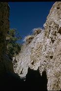
Title: Crack on ridge of Chalk Mountain
Creator(s): Slemmons, David B.
 Identifier: Image-S699
Title: East side of Chalk Mountain
Creator(s): Slemmons, David B.