
The Earthquake Engineering Online Archive NISEE e-Library
 Identifier: Text-S23286
Title: Geologic principles for prudent land use : a decisionmaker's guide for the San Francisco Bay region
Creator(s): Brown, Robert D.; Kockelman, William J.
Identifier: Text-S27211
Title: The Parkfield-Cholame, California, earthquakes of June-August 1966; surface geologic effects, water-resources aspects, and preliminary seismic data
Creator(s): Brown, Robert D.
Identifier: Text-S27219
Title: Geologic and seismologic aspects of the Managua, Nicaragua, earthquakes of December 23, 1972
Creator(s): Brown, Robert D.; Ward, Peter L.; Plafker, George
Identifier: Text-S28960
Title: Map showing recently active breaks along the San Andreas and related faults between the northern Gabilan Range and Cholame Valley, California
Creator(s): Brown, Robert D.
Identifier: Text-S28961
Title: Map showing recently active breaks along the Green Valley Fault, Napa and Solano Counties, California
Creator(s): Frizzell, Virgil; Brown, Robert D.
Identifier: Text-S29970
Title: Active faults and preliminary earthquake epicenters (1969-1970) in the southern part of the San Francisco Bay Region
Creator(s): Brown, Robert D.; Lee, William H.
Identifier: Text-S29977
Title: Faults that are historically active or that show evidence of geologically young surface displacement, San Francisco Bay Region : a progress report: Oct. 1970
Creator(s): Brown, Robert D.
Identifier: Text-S29981
Title: Map showing recently active breaks along the San Andreas Fault between Pt. Delgada and Bolinas Bay, California
Creator(s): Brown, Robert D.; Wolfe, Edward W.
Identifier: Text-S29996
Title: Active faults, probable active faults, and associated fracture zones, San Mateo County, California
Creator(s): Brown, Robert D.
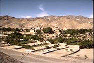
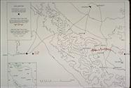 Identifier: Image-S3610
Title: Sketch topographic map
Creator(s): Brown, Robert D.
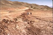 Identifier: Image-S3611
Title: Fault break
Creator(s): Brown, Robert D.
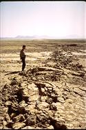 Identifier: Image-S3612
Title: Fault break
Creator(s): Brown, Robert D.
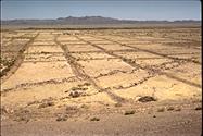 Identifier: Image-S3613
Title: "Gridiron" field pattern
Creator(s): Brown, Robert D.
 Identifier: Image-S3614
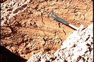
Title: Close-up of fault plane
Creator(s): Brown, Robert D.
 Identifier: Image-S3615
Title: Offset earthen wall
Creator(s): Brown, Robert D.
 Identifier: Image-S3616
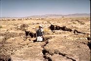
Title: Lurch fractures in cemetery
Creator(s): Brown, Robert D.
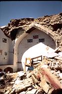
 Identifier: Image-S3617
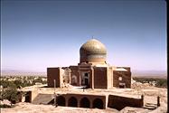
Title: Damaged mosque at Kakhk
Creator(s): Brown, Robert D.
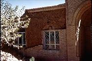
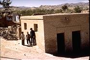 Identifier: Image-S3618
Title: Small undamaged brick building
Creator(s): Brown, Robert D.
 Identifier: Image-S3619
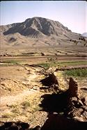
Title: Distant view of ruined village
Creator(s): Brown, Robert D.
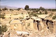 Identifier: Image-S3620
Title: Distant view of ruined village
Creator(s): Brown, Robert D.
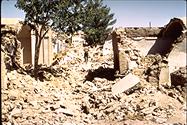 Identifier: Image-S3621
Title: Rubble-filled street
Creator(s): Brown, Robert D.
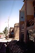 Identifier: Image-S3622
Title: Damaged two-story structure
Creator(s): Brown, Robert D.
 Identifier: Image-S3623
Title: Brick facing over sun-dried brick
Creator(s): Brown, Robert D.
 Identifier: Image-S3624
Title: Bazaar shop shows typical construction
Creator(s): Brown, Robert D.