|
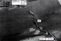
Image-B1001
Collapse of Japan National Railway bridge: aerial view of damage. Kuzurya Bridge.
|
|
|
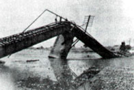
Image-B1002
Collapse of Japan National Railway bridge: damage to Pier 6.
|
|
|
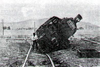
Image-B1003
Toppled locomotive in Japan National Railways Fukui marshalling yard.
|
|
|
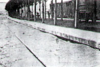
Image-B1004
Platform subsidence of Japan National Railway station at Fukui.
|
|
|
Image-B1005
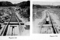
A small railroad bridge 1/2 mile northeast of Kanazu. Disruption of the railroad bed is greater than would normally be expected from slumping due to vibration alone.
|
|
|
Image-B1006
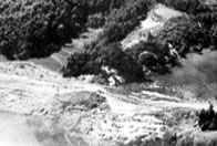
This railroad embankment has slumped out and down. Fiissures appear as long, irregular streaks of white. The site is 1/2 mile northwest of Kanazu.
|
|
|
Image-B1007
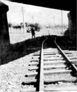
A fault zone along which horizontal displacement occurred crosses the right of way. The man's arms are aligned in the direction of disruption observed in the walls of the abutment.
|
|
|
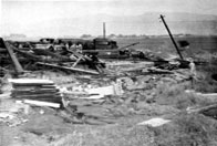
Image-B1008
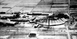
The railroad yard was built on former rice fields and covered by 3 feet of sand surfaced with cinders. Note the slump cracks at the south end of the yard.
|
|
|
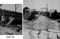
Image-B1009
Left: A 'heave' of light objects and slump of filled ground is illustrated by the relative position of the man's feet on what was formerly level ground. Right: Overturning of locomotives due to unequal compaction of roadbed and lateral flow.
|
|
|
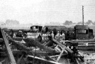
Image-B1010
Overturned stone gate posts of the railroad yard and some slump detail.
|
|
|
Image-B1011
Detail of overturned locomotives in Fig. 39e (B1010), Fukui railroad yard.
|
|
|
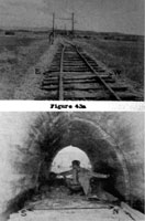
Image-B1012
The westward bend in the railroad tracks in the upper photo is located directly over the fractured culvert in the lower image. The figure's outstretched arms indicte the NE-SW strike of the widest crack. 2 miles north of Fukui.
|
|
|
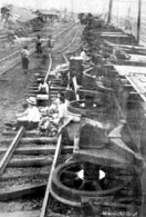
Image-B1013
Overturned locomotive within the city of Fukui.
|
|
|
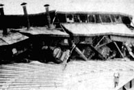
Image-B1015
View of locomotives under collapsed roundhouse at Fukui railroad yard.
|
|
|
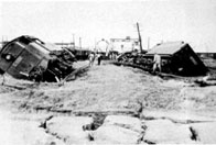
Image-B1016
Overturning of locomotives due to unequal compaction of roadbed and lateral flow.
|
|
|
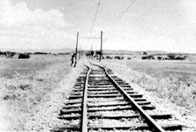
Image-B1017
The westward bend in the railroad tracks is located directly over a fractured culvert. About 2 miles north of Fukui. Same as upper photo in B1012.
|
|
|
Image-B1018
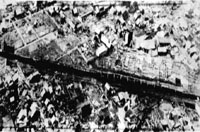
Aerial view of derailed, overturned train.
|
|
|
Image-B1019
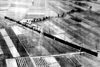
Aerial view of overturned train with passenger cars.
|
|
|
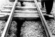
Image-B1020
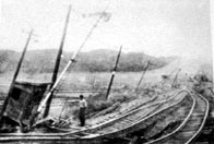
A stretch of embankment just south of Kanazu. The residual displacement of the embankment left the track very twisted and sinuous.
|
|
|
Image-B1021
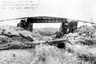
There is extreme subsidence of the immediate approaches to a small bridge. Between Morita and Kanazu.
|
|
|
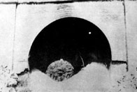
Image-B1022
Close-up view of a large fissure in a section of roadbed, between the rails. Between Morita and Kanazu.
|
|
|
Image-B1023
Brick-lined tunnel with cracked portals and cave-in near town of Kumasaka, north of Kanazu.
|
|
|
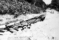
Image-B1024
Railroad embankment movement resulting in upside down stretch of rails and ties.
|
|
|
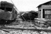
Image-B1025
Interurban car crushed by station collapse.
|
|
|
Image-B1026
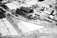
Interurban car barn, northeast Fukui City. Shows 2 overturned interurban passenger and freight cars, some tank cars, and a damaged car barn.
|
|
|
Image-B1027
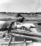
View from the south abutment looking north down the former centerline of the bridge. This bridge had a length of 840 ft. with 11 combination concrete and brick piers, and 12 spans of 2 parallel plate girders which supported the track structure.
|
|
|
Image-B1028
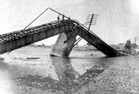
View of the 7th pier from the south side. Braced by the felled girders, this pier was still standing in an inclined position. The prime cause of failure was the lack of continuity in the pier construction.
|
|
|
Image-B1029
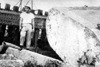
Sheared-off pier top, Kuzuryu River Bridge. This bridge had a length of 840 ft. with 11 combination concrete and brick piers, and 12 spans of 2 parallel plate girders which supported the track structure. The prime cause of failure was the lack of continuity in the pier construction
|
|
|
Image-B1030
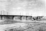
Southeast side view of Kuzuryu River Bridge, Keifuku Electric Railroad. This was a single track bridge spanning the Kuzuryu River and located about 1500 ft. west of the Nakatsuno highway bridge. It consisted of 10 concrete piers supporting 11 spans, each consisting of 2 parallel plate girders on which the rail structure rested.
|
|
|
Image-B1031
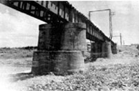
Failure of 2nd pier, Kuzuryu River Bridge, Keifuku Electric Railroad. This was a single track bridge spanning the Kuzuryu River and consisting of 10 concrete piers supporting 11 spans. The top of the 2nd pier from the south sheared off cleanly and horizontally, the top portion being displaced to the southwest.
|
|
|
Image-B1032
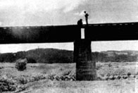
Failure of 2nd pier, Kuzuryu River Bridge, Keifuku Electric Railroad. This was a single track bridge spanning the Kuzuryu River and consisting of 10 concrete piers supporting 11 spans. The top of the 2nd pier from the south sheared off cleanly and horizontally, the top portion being displaced to the southwest.
|
|
|
Image-B1033
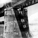
The anchorage of the girders to the piers appeared stronger than in the other bridges that failed, but close inspection showed that the anchor rods were very small. The anchor bolts pulled out of the pier as the girders were displaced to the south. Failure was due to instability of pier foundations, lack of necessary pier reinforcement, and weak anchorages.
|
|
|
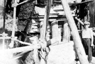
Image-B1034
South side view of center pier Kanazu Bridge, Government Railroad. This bridge over the Takeda River had 3 brick piers all of which failed. The center pier failed by shearing off on a horizontal line.
|
|


