|
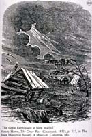
Image-KZ600
Cabins shaken and damaged. People outside in panic. (Near New Madrid, Missouri)
|
|
|
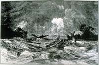
Image-KZ601
Rough waves on the Mississippi River, near New Madrid, Missouri (Near New Madrid)
|
|
|
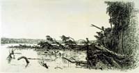
Image-KZ602
Riverbanks falling into the Missouri River. Trees broken and leaning. (Missouri River)
|
|
|
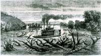
Image-KZ603
Steamboat navigating the river full of uprooted trees and snags. (Missouri River)
|
|
|
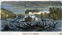
Image-KZ604
Steamboat navigating the Missouri River full of uprooted trees and debris. (Tinted version of KZ603, caption in Czech)
|
|
|
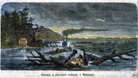
Image-KZ605
Clearing a passage for the riverboats on the Missouri River. (Colored engraving, caption in Czech)
|
|
|
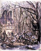
Image-KZ606
Artistic impression of clearing debris from the Mississippi, near New Madrid, Missouri. (Caption in German)
|
|
|
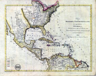
Image-KZ950
Map of the West Indies, the United States, and northern part of South America. Includes Mexico, Colombia, Central America, etc. The New Madrid area, including the Mississippi and Missouri River valleys, is indicated on the map suggesting European interest in the 1811-12 earthquakes. The dark line up the center of the U.S. indicates the western edge of the recently acquired Louisiana Purchase and the boundary with Spanish-held territories. Various colonial powers are indicated by color; see lower left corner for legend.
|
|