
Earthquake Damage to Railroads
W. G. Byers Collection: 1906-1908
|
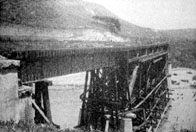
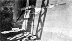
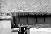
Image-B0501 Fault rupture crossed under deck truss span supported on falsework at an angle of about 40 degrees causing piers to separate due to right lateral slip. View taken May 30,1906. | |
|
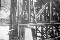
Image-B0502 First intermediate pier, west end, Pajaro River Bridge, Southern Pacific Railroad. | |
|
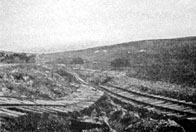
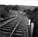
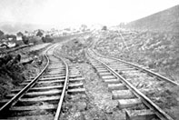
Image-B0503 Tomales, Marin County. The North Shore Railroad and the earthquake Rift. | |
|
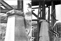
Image-B0504 Pajaro River Bridge, Southern Pacific Railroad: (left) Pier 2, (right) Pier 5. Near Watsonville, California. | |
|
Image-B0505 Base of Pier 3, Pajaro River Bridge, Southern Pacific Railroad. Near Watsonville, California. | |
|
Image-B0506 Bridge 39, North Shore Railway after the earthquake. (Near Pt. Reyes) | |
|
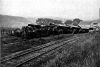
Image-B0507 Passenger train at Pt. Reyes, North Shore Railway, overturned by the earthquake. | |
|
Image-B0508 Dislocated bridge supported by falsework. Pajaro River at Chittenden. | |
|
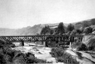
Image-B0509 Steel bridge over Pajaro River, near Chittenden (Santa Cruz County) dragged from its abutment 3.5 feet. | |
|
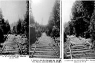
Image-B0510 A. Small railway trestle, Little North Fork, Gualala River looking north. Main fault trace 100 ft. to the right. Auxiliary crack under trestle. B. Buckled track, Little North Fork, Gualala River. Both rails broken, fault trace parallels track 50 ft. to the left. C. Buckled track, Little North Fork, Gualala River. Fault trace 100 ft. to the left. | |

|
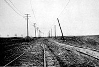
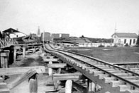
Image-B0511 Roadbed and rails of electric railway on marsh west of San Bruno. | |
|
Image-B0512 Roadbed and rails of electric railway between Baden and San Bruno. | |
|
Image-B0513 Shortening of railroad track between Los Gatos and Santa Cruz. | |
|
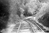
Image-B0514 Earth-slump north of Tomales carried railway roadbed with it. Track was straight before earthquake. | |
|
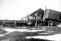
Image-B0515 Moss Landing. Lurching of ground toward Salinas River carried piles from beneath bridge timbers and caused bridge to collapse. (Monterey county) | |
|
Image-B0516 Moss Landing. Lurching of ground toward Salinas River, to the left, carried piles from beneath bridge timbers and caused bridge to collapse. Displacement was 9 ft. (Montery County) | |
|
Image-B0517 Moss Landing. Deformation of surface due to lurching of ground toward Salinas River. (Montery County) | |
|
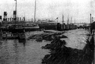
Image-B0551 Embankment settlement in harbor, Messina. | |
|
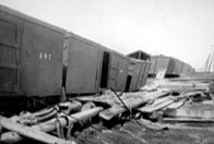
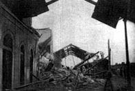
Image-B0552 Ruins of the railway terminal, Messina. |
 W. G. Byers Collection
